Can You Build on Wetlands? Florida Rules and the NWI Map
Sometimes, but usually only with a permit. Check the National Wetlands Inventory map before you offer.
Sometimes, but usually only with a permit, and sometimes not at all. Whether a lot can be built on depends on how much of the buildable ground is wetland and which federal, state and local rules apply. In Florida that means the state's Environmental Resource Permit program, plus a federal Section 404 permit when the work touches federal waters.
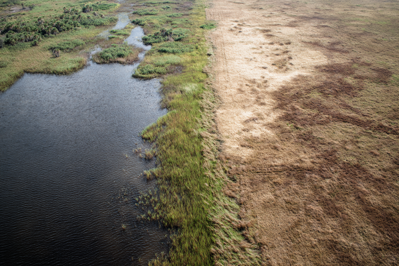
Wetlands kill deals quietly. A flat, dry-looking field in October can be a wetland in March, and the listing will not mention it. If your end buyer finds out after closing, permits can take months and costs can break the deal. Screen every parcel before you offer.
Quick check before you buy
- 1.Open the National Wetlands Inventory (NWI) Wetlands Mapper and find the parcel.
- 2.Note whether any mapped wetland polygon touches or overlaps the lot.
- 3.If it does, judge how much of the buildable area it covers.
- 4.If the map shows nothing, look at the lot anyway. Flat ground, drainage lines, seasonal water and dark mucky soil all count as warning signs.
- 5.Check the USDA Web Soil Survey for hydric soils on any parcel that looks suspicious.
- 6.Look at aerial imagery from more than one season.
- 7.Call the county and the state permitting office before you spend delineation money.
- 8.Decide whether the price justifies a professional wetland delineation. If not, price the doubt into your offer or pass.
National wetlands inventory: check it yourself, step by step
You need a browser and the parcel's location. Screening takes no wetland scientist. Site layouts change, so the labels below may differ from what you see.
Step 1. Open the NWI Wetlands Mapper. The U.S. Fish and Wildlife Service runs it, and its Wetlands Mapper page links to the live map, a documentation manual and a how-to video. The map itself is hosted on a USGS server, so expect the address to change. It is free.
Step 2. Find your parcel. Close the disclaimer, then click "Find Location" in the top bar and enter an address or coordinates, or pan and zoom to the spot. Rural lots often lack an address, so use coordinates from your county GIS parcel viewer. Confirm the map is centered on the right ground.
Step 3. Turn on the wetlands layer and look at the polygons. The mapper draws wetland polygons over aerial imagery. Check whether any polygon touches or overlaps your parcel. Zoom in to the boundary between mapped wetland and the rest of the lot. If no polygons show, switch the wetlands layer on in the layers or legend control.
Step 4. Read the code. Each polygon carries a classification code that describes the wetland type. Click the polygon, read the code, and look it up in the mapper's legend or the USFWS documentation manual. The legend is the authority, so do not guess at colors from memory.
Step 5. Judge size and location. A small drainage corridor at the lot's edge is a smaller problem than a polygon across the only flat, buildable ground. Note roughly what share of the usable area it covers.
Step 6. Cross-check with aerial imagery. Turn off the wetlands layer and look at the plain imagery. Look for drainage patterns, standing water and vegetation that changes color across the lot. Then check older images: Google Earth has a historical imagery option, and a dry lot in one season can look different in another.
Step 7. Check the soil. Open the USDA Web Soil Survey, mark your parcel as the area of interest, and look for hydric soils. Hydric soils formed under saturated conditions and are a strong sign that wetlands are possible. Follow its on-screen prompts, since the labels change.
Step 8. Save your evidence. Screenshot the NWI result with the date, the imagery and the soil result.
Step 9. Call the people who set the rules. The map only screens. Your county planning office and your state environmental agency tell you which local and state rules apply. Ask them before you spend delineation money.
What NWI is, and what it is not
NWI is a national dataset of wetland and deepwater habitats. It was built mostly by interpreting aerial photographs, and in many areas the data is old. It was designed as a habitat inventory. The Fish and Wildlife Service states that the mapper uses a biological definition of wetlands, makes no attempt to define the limits of any government's jurisdiction, and should not be read as showing whether a wetland is covered by federal, state, Tribal or local law. Its page also points anyone planning work near wetlands to the local Army Corps regulatory office. Treat it as a screening map.
This affects your money. A photo-based map most often misses small, forested or seasonally wet wetlands, and inland rural parcels have plenty of them. If NWI shows wetlands on the lot, you have a known concern. If it shows nothing, the lot is unconfirmed, and you should not call it clean.
Can you build on wetlands in Florida?
In Florida the answer is "maybe, with permits." Two permit tracks can apply to the same lot.
State: the Environmental Resource Permit (ERP). Florida's DEP describes the ERP program as covering activities that alter surface water flows, including new upland construction that produces stormwater runoff and dredging and filling in wetlands and other surface waters. Depending on the project, you apply to the DEP or to one of the state's five water management districts. (Florida DEP, Environmental Resource Permitting) Ask which office handles your lot, since it depends on the county and the project.
Federal: the Section 404 permit. Filling a wetland that counts as federal waters can require a Clean Water Act Section 404 permit. Florida's attempt to take over that program has gone to court. A federal court vacated EPA's approval of the state program in February 2024, and EPA's page on state assumption says the Army Corps of Engineers is the permitting authority for dredged or fill material in Florida. (EPA, state assumption efforts) DEP's own page says state 404 activity is paused until a court orders otherwise, and that page was last updated in July 2024. (Florida DEP, State 404 Program) The litigation has kept moving, so confirm with FL DEP and the Army Corps' Jacksonville District who issues 404 permits on the day you apply. It will be the Army Corps or the state, depending on current status.
Wetland presence is also one of the five common reasons deals fall through at closing.
What to do with wetlands on your property (or the lot you are buying)
Work through these in order:
- 1.Map the wetland edge against the buildable area. Is there dry ground for a house, a driveway and a septic system?
- 2.Ask before you disturb anything. Clearing, filling or ditching a wetland without a permit can bring enforcement. The Clean Water Act lets the EPA issue compliance orders, seek court orders and seek civil or criminal penalties (33 U.S.C. 1319). Call the county and the state office first.
- 3.Get a delineation if the price warrants it. A qualified wetland scientist marks the actual wetland line on the ground. In Florida the state method is set out in Chapter 62-340 of the Florida Administrative Code, titled "Delineation of the Landward Extent of Wetlands and Surface Waters."
- 4.Redesign around it. A house pad on the upland edge with a setback from the wetland is easier to permit than a fill.
- 5.Price it or pass. If your buyer will need a permit you cannot size up, price that in.
The federal rule behind the maps
In May 2023 the Supreme Court decided Sackett v. Environmental Protection Agency. The Court held that the Clean Water Act reaches only wetlands that are "as a practical matter indistinguishable from waters of the United States." That requires a relatively permanent body of water connected to traditional navigable waters, and a continuous surface connection between that water and the wetland. (Sackett v. EPA, No. 21-454, decided May 25, 2023)
Wetlands still matter after Sackett. A wetland outside federal reach can still fall under state and local rules. In Florida, for example, the state's own ERP program covers dredging and filling in wetlands. The agencies can tell you how far each rule reaches on your lot, and the federal rules keep changing, so check current guidance.
Check federal rules first, then state, then local. All three must be clear before you tell a buyer wetlands are no barrier. For lots in Florida, state rules often bind hardest.
If you plan to tell buyers the lot is clear of federal jurisdiction, get that in writing from a professional first. We do not give legal advice, and your title company or an attorney can tell you how the rules apply to your lot.
When you need a professional delineation
A qualified wetland scientist visits the site, applies the published method for your state, studies soils, vegetation and water, and marks the boundary.
Cost varies with parcel size, terrain and location, so get two or three quotes. On a $5,000 flip (hypothetical), a delineation can eat the deal. On a $50,000 purchase (hypothetical) where buildability is the whole point, it may be worth it.
Get one when all three of these apply:
- The purchase price is significant.
- The lot shows any sign of wetlands, mapped or not.
- The end buyer will need to build.
If you skip it, price the risk. Only a delineation tells you exactly what you are buying. See The True Cost of Skipping Due Diligence for what skipping costs when it goes wrong.
Pricing and decision guide
This is a rough sorting, and no formula. Use it with comps from lots that sold.
- NWI shows nothing, terrain is ordinary, soils are not hydric: full price. Save the screenshots.
- NWI shows a small mapped wetland at the edge, buildable area untouched: modest discount, or full price if your buyer pool does not care.
- NWI shows nothing, but terrain looks wet or the soils are hydric: discount for the doubt, or pay for a delineation if the price is high enough.
- NWI shows wetlands across a large share of the usable area: deep discount or pass.
- Any lot where the buyer needs a permit you cannot size up: pass unless the price reflects it.
The wetlands check sits in the environmental stage of due diligence, next to your flood zone and soil checks.
Run it as a process
Pass one is the NWI map. Pass two is soils and seasonal imagery when anything looks off. Pass three is a wetland scientist on high-value parcels. More in manual vs. automated land verification.
Screening dozens of lots means running the NWI check on each one.
The full framework, including soil analysis and contamination screening, is in [The Complete Land Due Diligence Checklist for 2026](/articles/land-due-diligence-checklist). For what happens when wetlands are missed, see [The True Cost of Skipping Due Diligence](/articles/true-cost-skipping-due-diligence).